|
|
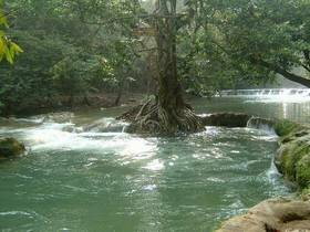
The name of Namtok Chet Sao Noi is from the story of the people in the area. For along time, seven ladies tourist drowned together in this waterfall. (Namtok=waterfall, Chet=seven, Sao Noi=young lady) and another story believed that it came from a village's name "Ban Sao Noi" (Pronounce shortly) and it became "Ban Sao Noi" until present. The most area of Namtok Chet Sao Noi National Park is ruggedly mountainous alternate with the plateau. The area rather dry with the shallow soil surface, height above msl is 180-402 m. The highest peak of the area is on the Chokchai Phatthana with 402 m above msl , next is the mountain range which is in the central of the area and Ban Dong Namcha mountain range 386, 359 m above msl following. The foothills are on the East and the North side, which near Khlong Muak Lek, there is a stream flows all year and tributary to Pasak river at Wang Muang district while the central area with streamlet flow through is Huai Laeng which has the stream in only rainy season. Chet Saonoi Waterfall Muak LeK Stream Tree tunnel |