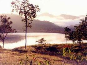
Doi Phu Nang National Park is situated in an approximate area of 512 square kilometers or 320,000 rai, covering the areas of Dok Kamtai District, Pong District, and Chiang-muan District of Phayao Province. There are different kinds of forests within the area of the National Park, including dense forests, mixed forests, and timber forests. The National Park also has beautiful natural sightseeing spots including Na-pang Waterfall, Thansawan Waterfall, which are abundant sources of rivers and gullies.
The geographical features of the National Park consist of high mountains, extending northwards. Meanwhile, Mae-yom Forest and Nampi Forest consist of high mountains extending like a horseshoe, as well as a low-lying land of Chiang-muan District situated in the middle of the two forests. Doi Phu Nang is the highest mountaintop of the two forests at the altitude of 1,202 meters (or 300 meters above the sea level) and being the source of major gullies flowing into Mae-yom River.
Na-bua Waterfall
Na-bua Waterfall is a 3-step limestone waterfall with the flowing water throughout the year, situated on the right-hand side of Mae-yom Forest next to Ban-bua, Moo 4, Tambol Sra, Chiang-muan District, Phayao Province. The Waterfall originated from Mae-jung Gully. Step 1 of the Waterfall is about 10 meters high and 6 meters wide; meanwhile, Step 2 is about 6 meters high and 15 meters wide, located in the northeast of Step 1 (approximately 5 km away); and Step 3 is about 20 meters wide, located in the north of Step 2 (approximately 500 meters away).
Natural Trail
The route for natural study, leading you to the beautiful scenery of Doi Phu Nang National Park, is about 2.105 km long and taking you approximately 3 hours by walking to the National Park.
Phang-ta
Phang-ta is situated within the joint between Nampi Forest and Mae-yom/ Nam-kuan Forest next to Baan Chaiyasathan Moo 4, Tambon Chiang-muan, Phayao Province. Phang-ta looks like Pae-muang-pi of Prae Province, originating from soil erosion at the site of a low mountain, leaving some 25-meter-high pointed soil-pillars connecting for an approximate distance of 200 meters. The geographical condition of Phang-ta consists of mountains and a laterite road connecting to Baan Chaiyasathan. Meanwhile, the surrounding areas of Phang-ta (approximately 3 rai) connecting to agricultural lands of Baan Chaiyasathan villagers on the mountaintop of Phang-ta, can be developed as sightseeing spots and recreational sites due to their flatness and beautiful scenery.
Thansawan Waterfall
Thansawan Waterfall or Bor-bia Waterfall is a 4-step rocky waterfall situated in the area of Mae-yom Forest next to Ban Bor-bia, Moo 6, Tambol Ban Yang, Chiang-muan District, Phayao Province. Step 1 of the Waterfall is about 8 meters high and being regarded as the most beautiful and the highest step of the Waterfall, falling from a 150-meter-wide limestone plate; meanwhile, Step 2 is about 2.50 meters high, and Step 3 and Step 4 of the Waterfall are about 2 meters high.
The Waterfall originated from the multi-branches Mae-ping Gully. The surrounding areas of the Waterfall consist of mixed forests and tropical evergreen forests, as well as the agricultural lands of Bor-bia villagers.