|
|
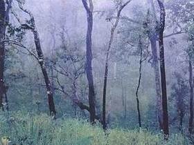
Nan National Park Center sent a document on April 7, 2541 to inform that Nan National Park Center which is, composed 6 National parks, fertile with natural forest resources and outstanding wildlife resources, high enough potential developed to be tourism place and recreation for people and with 480-640 sq.km of area so appropriated setting to be a national park On July 22, 1998 the Royal Forest Department had an order to sent officer operating surveyed this area and from surveying report found Huai Mae Khaning National Reserved Forest was attacked, cleared for agriculture and most of area was occupying attached. At present National park, Wildlife and Plant Conservation Department has offer the committee of National park at the second meeting on December 15, 2003 for setting this area with 419.20 sq.km to be a National park. Sloped complex mountainous laying north to south. The mountain ridge of Doi Prae Mueang separates boundary between Phrae and Nan provinces. There are many of rivers and streams such as Nam Sa, Nam Tha, Nam Haeng Nam Mae Sakhon etc. Main Mountain are Doi Ku Sathan with 1,630 m high, Doi Mae Chok with 1,424 m and the highest is Doi Phukha with 1,728 m high above msl. Doi Ku Sathan Doi Mae Chok Khun Li Waterfall La-ong Cave Scenery View Along the Road Sirikit Dam Tat Mok or Bansan Waterfall |