Khun Nan National Park covers the areas of Bor Gleur District of Nan Province within an approximate area of 248.6 square kilometers or approximately 155,375 rai. The National Park is situated in the area of Pa Doi Phooka and Pa Phadaeng National Conserved Forest in Tambol Phobphra, Tambol Bor Gleur Tai, and Tambol Dongphaya of Bor Gleur District, Nan Province.
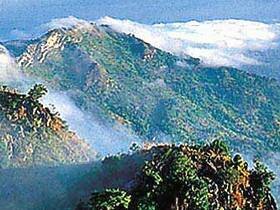
The geographical features of the National Park consist of high mountains in 1A Level upstream areas and having the watershed on the highest mountaintop situated in Tambon Dongphaya. Major mountains in the area include Phu Fa Mountains, Khun Namwahnoi Mountains, Namwahklang Mountains, and Pi Pun Mountains. Namwah River, originated from the watershed mountains, is a large and significant river flowing across the areas southwards.
Baan Den Waterfall
Baan Den Waterfall is a 3-major-step, medium sized waterfall with flowing water throughout the year (smaller than Sapun Waterfall). The heights of Step 1, Step 2, and Step 3 of the Waterfall are about 7 meters, 3 meters, and 5 meters, respectively. The Waterfall has moderately beautiful scenery of shady and cool forests. The Waterfall is situated approximately 1 km from Baan Sapun and must be reached by walking.
Huai Ha Waterfall
Huai Ha Waterfall is a 3-major-step, medium sized waterfall, with beautiful, scattered flows of water throughout the year (about the same size as Sapun Waterfall). The heights of Step 1, Step 2, and Step 3 of the Waterfall are about 8 meters, 12 meters, and 50 meters, respectively. The Waterfall has extremely beautiful scenery of shady and cool forests. In particular, on Step 3 (Tad Phadaeng Step) of the Waterfall, which is about 50 meters high, there are 5 small ladder steps of about 3-12 meters high each.
Huai Tee Waterfall
Huai Tee Waterfall is a 6-step, medium-sized waterfall with flowing water throughout the year. The heights of Step 1, Step 2, Step 3, Step 4, Step 5, and Step 6 of the Waterfall are about 30 meters, 20 meters, 25 meters, 15 meters, 10 meters, and 10 meters, respectively. The Waterfall has beautiful scenery of shady and cool forests.
Sapun Waterfall
Santisuk Waterfall is a 3-major-step, medium sized waterfall with flowing water throughout the year. The heights of Step 1, Step 2, and Step 3 of the Waterfall are about 3 meters, 5 meters, and 6 meters, respectively. The Waterfall has beautiful scenery of shady and cool forests.