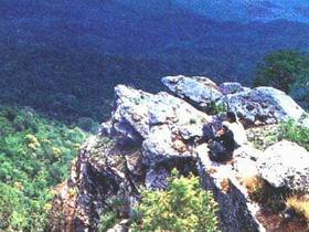
Since the areas of Nam-wa Forest and Mae Charim Forest, the southeastern part of Nam-Nan Forest, and Huai Sali Forest situated in Tambon Nam-pang, Tambon Nam-pai of Mae Charim District, and Tambon Lai-nan, Tambon Sanna Nhong-mai, Tambon Nam-muab of Viangsa District, Nan Province, consist of valuable natural resources including plants, wild fruits and wild animals, as well as beautiful scenery of forests, mountains, streams, and cliffs, it is deemed expedient to establish Mae Charim Forest as a national park under the National Park Act 1961 for the purpose of conservation within an approximate area of 432 square kilometers or 270,000 rai.
The geographical features of the National Park consist of high mountains, extending from the north to the southwest, and Luang Phra-bang Mountains extending from the north to the south (and being used as the boundary between Thailand and Laos). The height of mountains lowers to the west. Doi Khun-lan, situated in the east of the National Park, is the highest mountaintop (1,652 meters above the medium sea level) where Wa River flows from Luang Phra-bang Mountains passing the west of the area for approximately 7.5 kilometers.
Rafting on the Wa River
Rafting is major recreational activity of the National Park. The route for rafting starts at Ban Nam-pu, Tambol Nam-phong of Mae Charim and finishes at Ban Had-rai, Tambol Sanna Nhong-maiof Viangsa District, Nan Province, totally 19.2 kilometers. In addition, there are islets and reefs along the rafting route for your adventurous experiences. Many spots are provided for tying up the rafts on the riverbank while you are swimming. And the scenery on both sides of the River is very beautiful, particularly in winter. You may enjoy rafting activities in all seasons except in the rainy season due to floodwaters.